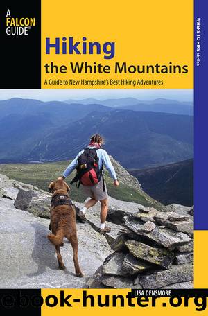
Hiking the White Mountains by Lisa Ballard

Author:Lisa Ballard
Language: eng
Format: epub
Tags: FalconGuides, day hikes, hiking, hikes, hiking trails, day hikes, wilderness, national forest, national parks, wildlife, nature
Publisher: Falcon Guides
Published: 2013-09-11T00:00:00+00:00
Hikers crossing Webster Cliffs
Though it sits in the Presidential Dry River Wilderness like a gatekeeper to the Presidential Range, Mount Jackson was not named for President Andrew Jackson. The mountain is named for the New Hampshire State Geologist, Charles Jackson, who supervised the first survey of New Hampshire from 1839 to 1841. (Jackson did little of the fieldwork himself.) You can see thirty 4,000-footers from the summit of Mount Jackson, though the highlights are the spectacular view of the Presidential Range crowned by Mount Washington at the head of Oakes Gulf and the Dry River Valley, and the Montalban Ridge connecting Stairs Mountain, Mount Davis, and Mount Isolation to Boott Spur on Mount Washington on the east side of the Dry River Valley. The 360-degree view also includes Mount Chocorua to the east and the many high peaks that ring the Pemigewasset Wilderness to the south.
At the summit signs, bear left (northwest) on the Jackson branch of the Webster-Jackson Trail (blue blazes), leaving the AT. The initial descent to the trees on low-angle slab can be challenging if wet. Cracks in the rock give some traction. The rocky, slabby route turns to a rubbly, rock-strewn path by 5.1 miles before finally becoming a regular footpath again.
The trail continues to descend aggressively into tall evergreens, coming to the junction with the Webster branch of the Webster-Jackson Trail back to Mount Webster at 5.9 miles. Note: If you only have one car, you can do this route as a long lollipop hike (10.3 miles total), turning left here, climbing back over Webster, and traversing the cliffs in the opposite direction. With a car drop, bear right (northwest), continuing downhill on the Webster-Jackson Trail. A short spur from this intersection goes to Emerald Pool, which is worth the quick side trip to see the beautiful cascade and the small jewel green pool at its base.
At 6.4 miles, the Webster-Jackson Trail crosses a streamlet, then climbs stone steps before continuing to traverse and descend to the northwest. The footing is much smoother now, soon crossing a sizeable stream above a smooth-rock cascade.
At 7.4 miles, a short spur to Bugle Cliff departs to the left (south), where you can get a birdâs-eye view of the AMC Highland Center and the Mount Washington Hotel. From there, the trail drops in waves to the west on well-placed stone steps. The trail passes a spur to Elephant Head, another excellent lookout, before emerging from the woods by Saco Lake at 7.8 miles.
Download
This site does not store any files on its server. We only index and link to content provided by other sites. Please contact the content providers to delete copyright contents if any and email us, we'll remove relevant links or contents immediately.
Giovanni's Room by James Baldwin(7299)
The Plant Paradox by Dr. Steven R. Gundry M.D(2596)
The Stranger in the Woods by Michael Finkel(2506)
Miami by Joan Didion(2353)
Wild: From Lost to Found on the Pacific Crest Trail by Cheryl Strayed(2243)
INTO THE WILD by Jon Krakauer(2187)
Trail Magic by Trevelyan Quest Edwards & Hazel Edwards(2164)
DK Eyewitness Top 10 Travel Guides Orlando by DK(2163)
Vacationland by John Hodgman(2118)
The Twilight Saga Collection by Stephenie Meyer(2115)
Nomadland by Jessica Bruder(2050)
Birds of the Pacific Northwest by Shewey John; Blount Tim;(1954)
The Last Flight by Julie Clark(1937)
Portland: Including the Coast, Mounts Hood and St. Helens, and the Santiam River by Paul Gerald(1907)
On Trails by Robert Moor(1884)
Deep South by Paul Theroux(1818)
Blue Highways by William Least Heat-Moon(1755)
Trees and Shrubs of the Pacific Northwest by Mark Turner(1706)
1,000 Places to See in the United States and Canada Before You Die (1,000 Places to See in the United States & Canada Before You) by Patricia Schultz(1634)
